
A January thaw is in store for this week with flooding potential into Sunday.
|
0 Comments
Our stretch of great weather will not continue today as a warm front lifting northward will bring scattered showers to the region. 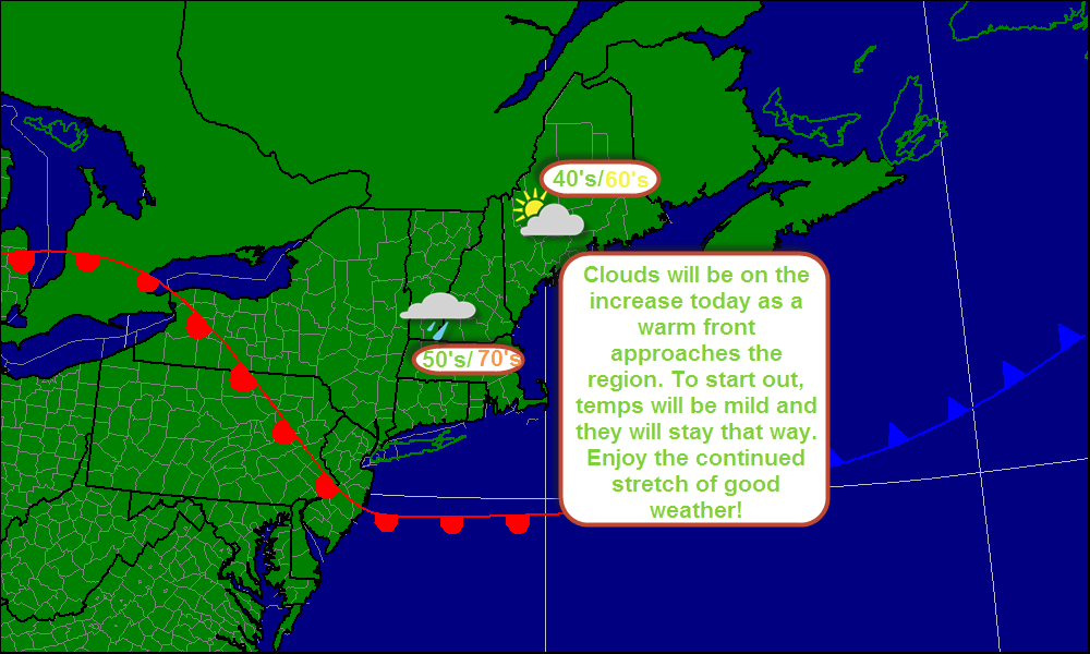
-Jack
Forecaster, Bweather Chief forecaster NESU As the image below shows, another great day in on tap continuing an amazing streak of good weather. However, its not going to last. 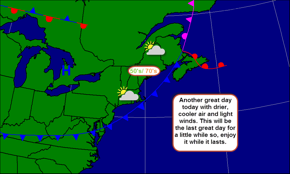
-Jack
Forecaster, Bweather Chief forecaster, NESU Our stretch of great weather continues as the Bermuda High is in control of our weather. Things will heat up today as a cold front approaches. However, the passage of the cold front will merely be a reduction of clouds and a change in dew points. 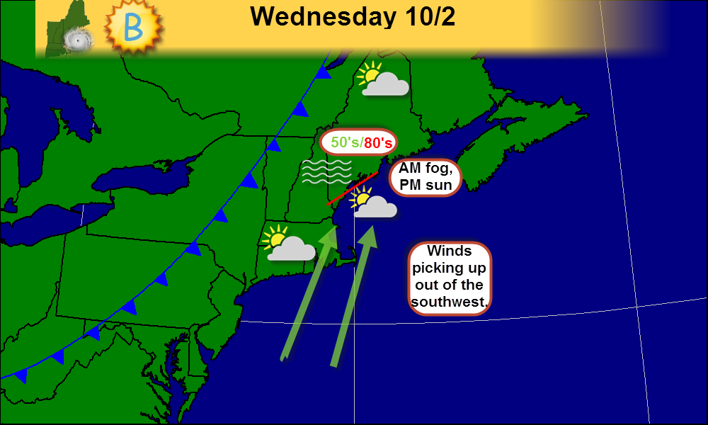
Enjoy!
-Jack Forecaster, Bweather Chief forecaster, NESU 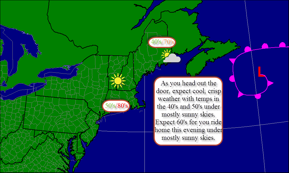
Enjoy the great weather! More to come!
-Jack Chief forecaster, NESU Forecaster, Bweather 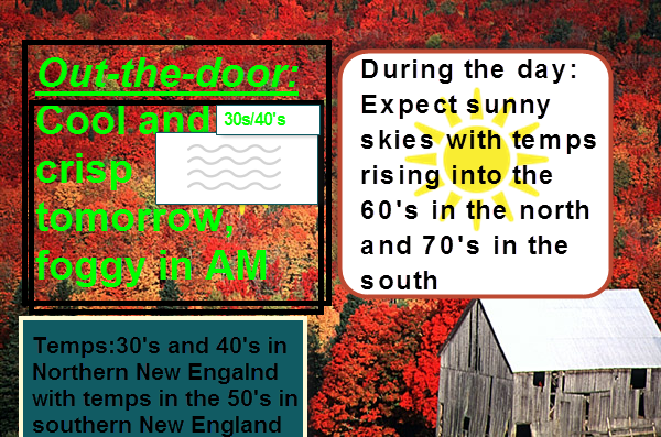
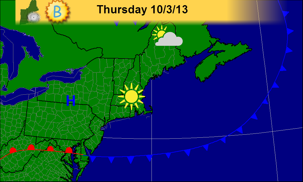
We have another great day on tap today! After some early morning fog burns off, we should have sunny skies with just a few high clouds at the coast but nothing too big.
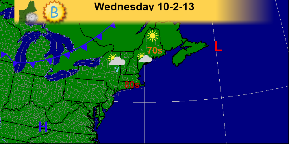
-Jack Forecaster, Bweather Chief forecaster, NESU A beautiful week weather-wise is in store across New England. With clear skies, mild temps and a storm-free forecast, enjoy the first week of October! 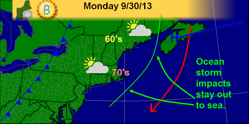
Enjoy the first week of October!
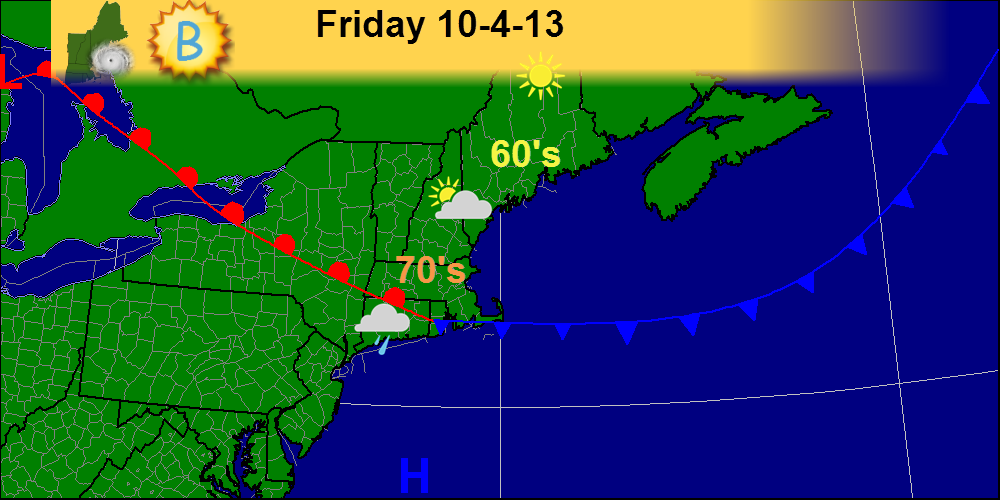
-Jack Forecaster, Bweather Chief forecaster, NESU As the models back off on the storm that we thought was coming the weather get nicer and nicer. The rest of Today will be mostly sunny. Highs in the lower 60s at the coast to the upper 60s inland. 
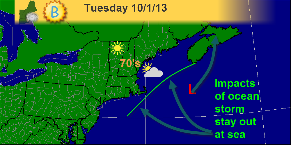
Overnight we received the new model run that starts off each day. In this model run, all the models shifted eastward and formed a tight consensus on track/intensity. Also notice, the models have slowed down just a tad. However, this won't really matter as the storm is not likely to affect even the coast at this point. Just a slight increase in cloudiness and maybe, maybe a shift in winds. The one possible exception would be Cape Cod. That area might receive a brief shower or two but nothing significant for them either. TD 11 in the Atlantic basin- Overnight, TD 11 formed in the Central Atlantic. It is forecast to do a little loop-de-loop then go out to sea. No impacts will be felt here in New England. In fact, before satellites in the 1960's we probably wouldn't of known it was there. Top winds right now are 35mph The minimum pressure is 1010mb It is moving Northeast at 9mph Check our tropical weather resources tab under "Links" above for some sites to get even more information about this storm. 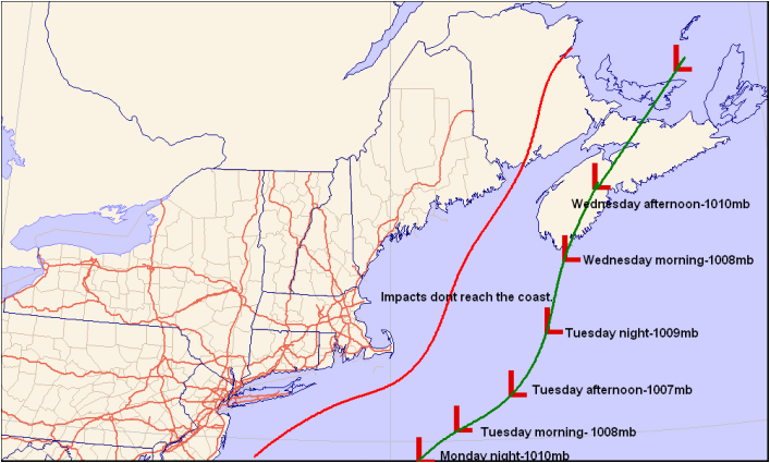 This is my forecast for the storm's track, intensity, and the western periphery or the precipitation. Notice that it's much farther to the east and weaker than previously thought. Also notice, the models have slowed down just a tad. However, this won't really matter as the storm is not likely to affect even the coast at this point. Just a slight increase in cloudiness and maybe, maybe a shift in winds. The one possible exception would be Cape Cod. That area might receive a brief shower or two but nothing significant for them either. TD 11 in the Atlantic basin- Overnight, TD 11 formed in the Central Atlantic. It is forecast to do a little loop-de-loop then go out to sea. No impacts will be felt here in New England. In fact, before satellites in the 1960's we probably wouldn't of known it was there. Top winds right now are 35mph The minimum pressure is 1010mb It is moving Northeast at 9mph Check our tropical weather resources tab under "Links" above for some sites to get even more information about this storm.  I've highlighted TD 11 on this infrared satellite image as it is very hard to figure out where it might be (I had to double check the coordinates because I was unsure). You can clearly see a cold front sweeping across the US as well as (but not as clearly) a trough of low pressure in the Caribbean that will eventually move into the Gulf and hit the Gulf coast, possibly as a tropical entity. We'll have to watch it very carefully as it could cause problems. Even here in New England, the remnants could bring some decent rain.
-Jack Sillin, Chief forecaster, NESU (New England Storm Updates) Forecaster, B Weather Chief writer Forecasterjack The 12z model run shows great disagreement between models as the ocean storm slated to hit Monday approaches. I'll start by going over some of the things that are very clear. -This will not be a significant storm. There is agreement that there will be nothing more than rainy and breezy conditions at the very worst with a much more likely scenario being that the immediate coast gets affected with a band of light rain and breezy conditions. -Timing. There is solid agreement that the rain, if any, will impact the region late Monday into early Tuesday. Not much disagreement on that front. However, the models still have to nail down 2 key aspects of the forecast. -Track. The general consensus it that the storm will come up the coast and move to the SE of the 40N 70W benchmark and then move north or north-northwest towards the Canadian Maritimes. -Intensity. The strength of the low is also very important. The NAM model has a 990mb low where the GFS has a 1008mb low. This ranges from pretty strong to pretty weak. What my forecast calls for. I think a storm of weak intensity will track just SE of the benchmark. It will then move N towards the Maritimes. I think that the only impacts will be a band of light rain affecting the coast and light winds also limited to the coast. 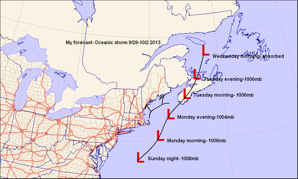
This is my forecast for the storm slated to affect coastal areas late Monday.
-Jack |
Archives
January 2014
Categories |
 RSS Feed
